The following does not constitute an endorsement of i-Tree by the University of Maryland Extension at the exclusion of other apps.—Editor
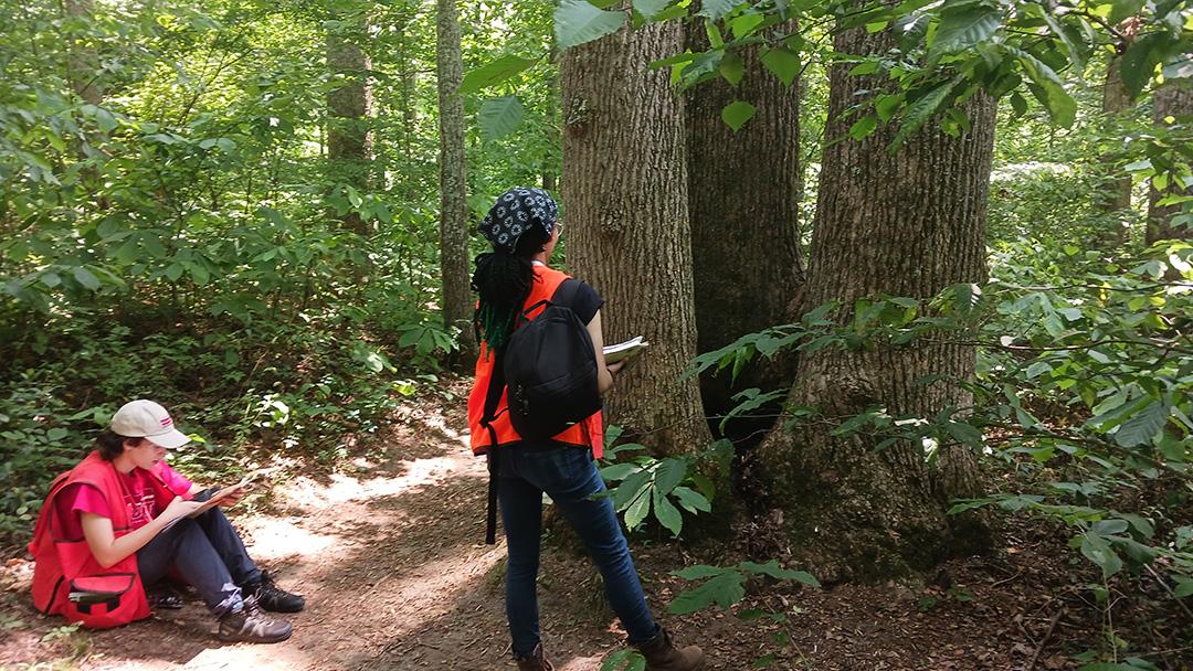
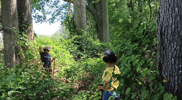
This past summer I had a project dropped in my lap to assess the landscape and forest trees at the University of Maryland’s Wye Research and Education Center (WREC) in Queenstown on the Eastern Shore. We were provided funding to hire two interns to complete the inventory and enter the data into i-Tree.

i-Tree is a collaborative effort of many partner organizations including USDA Forest Service, Davey Tree Expert Co., The Arbor Day Foundation, Society of Municipal Arborists, International Society of Arboriculture, Casey Trees, and SUNY College of Environmental Science and Forestry. i-Tree offers ten different programs providing varying levels of data and information, depending upon the user’s needs and how they plan to gather data for assessment. This includes tools to create assessments from individual trees or from landscape-scale acreage.
We chose to use the i-Tree Eco platform. i-Tree Eco allows you to enter inventory in two forms: individual tree or plot samples. Unfortunately, there is no version (yet) to share data from traditional forest plots and then assess the results. Also, as the Wye complex has scattered woodlands and landscaped areas, we would not be able to use one form of assessment to inventory the information. We decided to do an individual tree assessment on landscape trees and a plot sample assessment on the forested areas.
We trained the interns in a variety of skills, including using GPS; tree ID; measuring tree diameter and height; measuring crown spread, dieback, and percentage of canopy; and relative health. Over the course of eight weeks, they tallied the information for 1,024 trees that were landscaped throughout the campus. We also did a traditional forest sampling on 22 sample plots over the approximately 100 acres of woodlands. This data would be forwarded to Maryland Forest Service to be used in developing a forest stewardship plan.
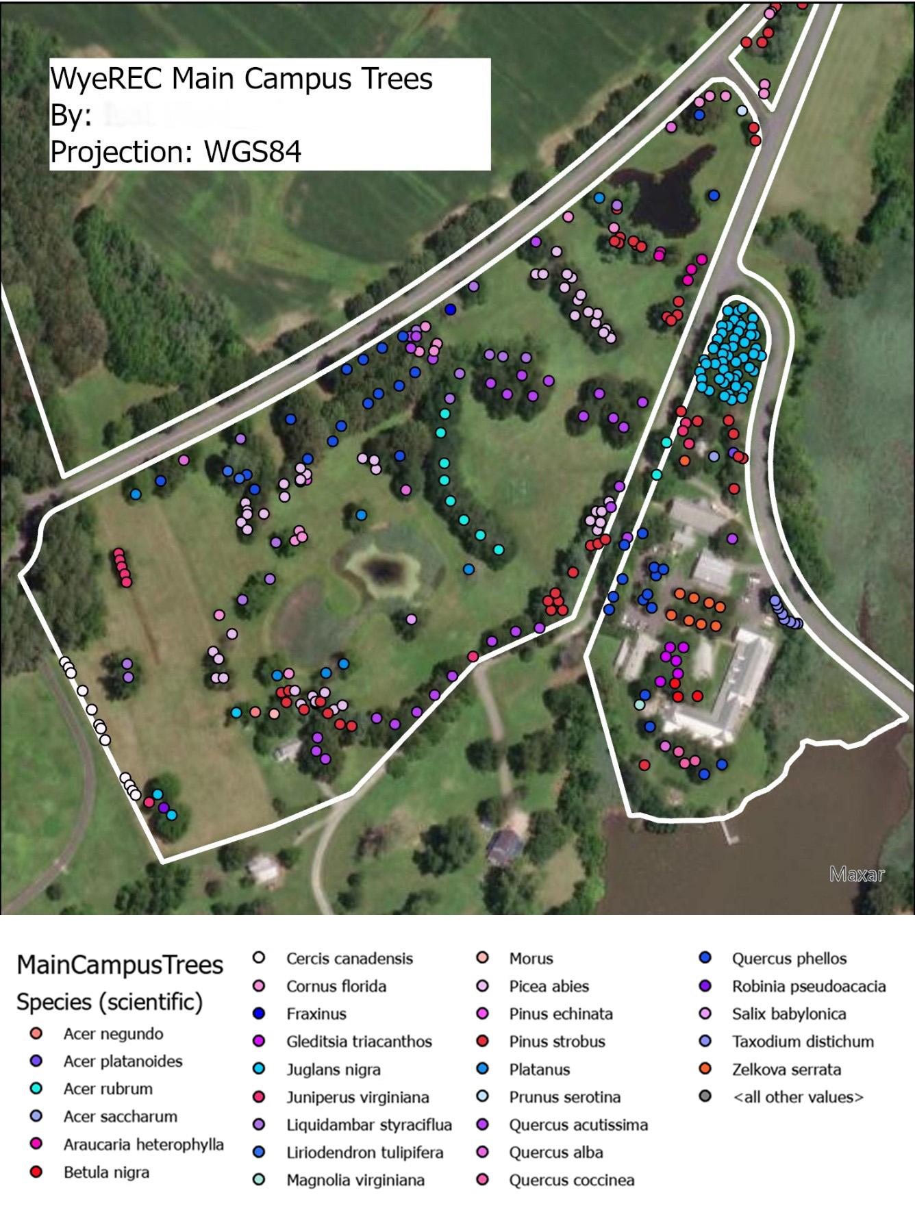
Once the individual tree data was entered into i-Tree Eco, it takes several hours for the results to be processed via remote servers at Davey’s headquarters in Chicago, IL. The results are dependent on your assessment. We furnished the interns with tablets to enter their field information directly into a spreadsheet while in the field, avoiding double data entry and reducing errors. This spreadsheet data was uploaded into i-Tree Eco to be processed. Meanwhile, we also input the GIS data to produce maps of the trees, types of trees, health of the trees, and more. We also used the parcel information to establish property boundaries and illustrate where the trees are in relation to other elements on the property, such as buildings, water features, the forest, and rivers.
i-Tree is a very powerful and useful tool. I would like to see more integration with GIS software to be able to appreciate more functionality. I also wish to see more integration of traditional forestry measurements derived from standard forest plot assessments, such as basal area, basal area per acre, trees per acre and quadratic mean stand diameter to readily calculate information from forest stewardship plans. If you are interested in seeing a full presentation of the results from our study, send me a request for a link to our presentation. If you have any questions about i-Tree and the assessment process, please contact me at jhooven@umd.edu or at 410-827-8056, extension 125.